
Four Summits, Four Hours: Conquering the Kite Lake Trail (Alma, CO)
Posted by Alex R. on Aug 25th 2015
I am a bit of black sheep in the outdoors community. I like hiking; I live for thin air and ascents through the timber line. I set pre-dawn alarms so I can watch a summit sunrise. But all of that goes out the window the second I say the following: I like front country hiking.
My ideal day consists of waking up pre-dawn, hitting the trail as soon as possible, and hiking until afternoon convection currents (and the thunderstorms they generate) physically force me off the summit. Where I go once I dust off my boots and hang up my pack, however, marks me as a “daytripper” (the ultimate insult) regardless of how hard I just climbed. My Scarlet Letter is pinned the second I leave the scree of a remote campground; because once off that summit, I return home. Not to a Big Agnes waiting just off the path – home, home. To a hot meal, a warm bed, and coffee I didn’t JetBoil. I’m not an indoors cat by any means; I just enjoy my creature comforts once I come inside.
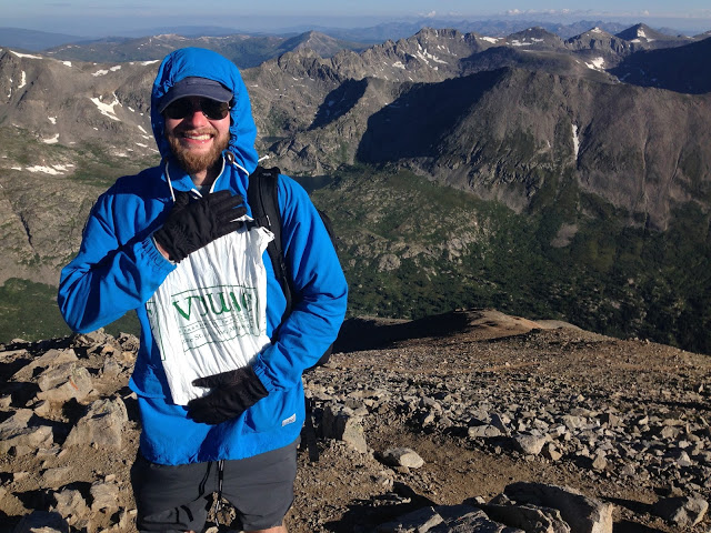
On the morning of Thursday, August 13th, I embraced my daytripper identity to the fullest and speed hiked four 14,000ft peaks in under four hours. Pretty wimpy, right?
The plan: leave my hotel just outside Breckenridge, CO and drive to the Kite Lake Trailhead in nearby Alma, CO in order to attempt “The Presidentials”: a 7 mile mountain circuit promising altitude-adjusted hikers four massive peaks in relative succession. I packed my gear the night before and went to bed shortly after sunset – even with my jet-lag, tomorrow would be an early morning.

My gear setup minus extra food and water: merino baselayer, Penfield cotton fleece crewneck,
DWR-coated nylon shell, and polyester running shorts with Vasque Breeze 2.0’s. I use a North Face Surge pack,
Garmin GPS for navigation, and a Petzl Tikka 140+ headlamp for when the going gets dark.
I set a 3am alarm in order to budget enough time for a quick breakfast (3:20), one final gear check (3:40), a 45 minute drive to the trail (4:25), and a projected two hour ascent in the dark to hit the first peak of four just in time for 6:15am sunrise. If everything went perfect, this would be my first “summit sunrise”.
Like everything in life, my best laid plans found themselves led astray by the unmaintained access road to reach Kite Lake. At 4:30am, our rental Chevy Impala bottomed out 2 miles away from the trail, so what was formerly a 7 mile trail (with enough time budgeted out to summit the first peak, Mt. Democrat, in time to see sunrise) became an 11 mile race against first light. I parked, strapped on my Petzl Tikka+ 140 headlamp, and took off running down the road. There was no way I’d miss that sunrise.

Through the miracle of modern LED lighting technology, I reached the trailhead around 4:50am with no twisted ankles and battery to spare for the ascent. Tent lanterns and headlamps dotted the campground: ironically enough, my front country start had put me ahead of many who had camped out. A quick change of baselayers (motto of the Boy Scouts: “be prepared!”) and a compass heading later, I was off at 5am Mountain Standard.
Elapsed time from drop-off: 0:30
Elapsed time from trailhead: 0:00

The Kite Lake Trail ascends around 1500′ out of Kite Lake Basin before hitting a saddle. The trail is fairly linear and clearly marked with only short portions of Class 2 as you get higher into the rocks. “Clearly marked” is relative – even with the light of the Perseid Meteor Shower above me and my Tikka+ below, I took a wrong turn at 12,600′ around 5:20am and ended up ascending a boulder field for close to half an hour. Not the smartest move.
Thankfully, I scrambled across the rock field to rejoin the trail around 13,100′, just above the saddle. My little detour had bled time, and I now had close to a thousand feet of vertical climb in the twenty minutes ahead if I was going to make the summit. I furrowed my brow, tied my boots, tightened my backpack… and made it as far as 13,900′ before the brilliance started at 6:15am. Sigh. So close, yet so far. That being said: sunrise over the Presedentials was one of the single most dazzling sights I’ve ever seen. Enjoy the pictures!


I summited Mt. Democrat (elevation: 14,148ft) at 6:29am, just as the last rays of the light show faded into perihelion golden hour. One down, three to go.
Elapsed time from drop-off: 1:59
Elapsed time from trailhead: 1:29

After descending Democrat, the trail continues along a rock saddle – coincidentally, the one I should have hit during the ascent – and ascends up an exposed ridgeline to the summit of Mt. Cameron. For close to an hour, you are buffeted by high winds amplified by the completely flat surfaces between you and cliff’s edge. Wind shelters, collapsed mining shacks, and winding trails dot the moonscape between you and Peak #2. So, I walked – even with North Face Thinsulate gloves, both hands were numb by the time I summited. In fewer words: this part sucks.

After forty minutes of gusting, unrelenting exposure, I finally found the summit marker at 7:30am.
Mt. Cameron (elevation: 14,238ft) – you may be the second tallest of four, but you were first place awful. No matter – half way there! Only two peaks left.
Elapsed time from drop-off: 3:00
Elapsed time from trailhead: 2:30


From the summit of Cameron, the trail continues across more scree wasteland for a ways before finally dipping below enough ridge to shield you from the wind. After descending to around 14,000′ and far from the summit, the trail dips and descends for the better part of 300′ – if you’re confident, this is a prime chance to run down a scree chute (for proper technique, check out this short video) A long walk across a wide open gravel field separates you from Peak #3, the highest of the quad. A clearly-trampled summit route provides an easy guide to a rock fin around 14,100′. Just follow the trail along that fin, try not to look down, and shimmy your way up and across. Snowpack, a US Geological Survey summit marker, and a rusted-out mining crank await you at the summit of Mt. Lincoln.
Mt. Lincoln (elevation: 14,286ft) was by far my favorite climb of the bunch. My arms-flailing run on the descent had put me ahead of schedule, and summit came a paltry half hour after Cameron. I clocked in at 8:01am, inhaled a granola bar, and with time on my side, sat back to enjoy the view. As the tallest peak in the immediate area, your view of the Rockies is as uninterrupted as can. Pictures don’t do it justice.
Elapsed time from drop-off: 3:31
Elapsed time from trailhead: 3:01


I spent a good ten minutes on the summit of Lincoln. Given the aforementioned wind, a quick breather was all that I could spare before I lost hand feeling again. So, at 8:12am, I left the summit and charted a course off towards the fourth – and final – peak of the day: Mt. Bross.

Another quick descent down a scree chute from Lincoln’s rock fin aligns you directly with the Bross bypass trail around 13,850′. Mt. Bross has perhaps the most colorful history of the Kite Lake Four: the summit was officially closed in 2005, due to a combination of hazards from the area’s former mining industry (abandoned shafts, collapsing tunnels, etc.) and the fact that Mt. Bross is technically on private land. “Trail closed” signs dot the long, gradual 1.5 mile uphill walk to the summit that first takes you into a gully on the west side of the summit before ascending a final 200′ to the peak. Or so I’ve heard from other people. Legal notice: Bivouac Ann Arbor and its employees respect all federal trespassing laws.

New life goal: own a mountain.
If I did indeed summit Mt. Bross (elevation: 14,172ft), I would’ve probably done it around 8:44am, considering the trail was the least difficult climb of the group and would only get slightly interesting around the “closed for restoration” signs that indicate the 2008 attempt to restructure the summit paths. Or so I assume. Ya know, from the internet.
Elapsed time from drop-off, probably: 4:14
Elapsed time from trailhead, if I had to guess: 3:44 (sub-four!)


The fourth peak definitely not ascended due to legal conflicts, I began my 2200′ descent back to the Kite Lake Basin. And for the first time all hike, I had company! Chris and Crystal, two seasoned adventurers and world travelers who I met on Bross (disclaimer: the preceding refers to anywhere on Mt. Bross, not the legally-restricted summit), took the lead as we made our way down 90 anxiety-filled minutes of rock slides and granite rubble. A big shout-out to my North Face Surge daypack for having enough surface area to act as an impromptu friction break during a longer slide.

Chris, Crystal, and I swapped travel stories as we inched our way down to the trailhead. I can’t thank them enough for the advice, destinations, and company – the descent would’ve been a whole other animal without them there. In the middle of a tale about volcano evacuations on Vanuatu (spoiler alert: their stories were better), the ground leveled out and we were finally off the mountain. Us three merry descenders shook hands, finished one last story, and parted ways just as my watch ticked 10:00am.
Elapsed time from drop-off: 5:30
Elapsed time from trailhead: 5:10

A two mile walk back to a parked rental Impala lay before me, but at this point, I just didn’t care. I was a proud front country weenie who hit four peaks in a single day, saw sunrise from above 14,000ft, and ran two miles in the dark to do it. I’d call that a morning well spent.
Bad case of Wanderlust? Plan your next trip by checking out all the details behind our visits to Canyonlands National Park (UT), Pictured Rocks National Lakeshore (MI), Boulder (CO),and Chicago (IL), or click here to go back to the Bivouac Blog!